CARTIF PROJECTS
CCliMAP
Help decision-making to reduce greenhouse gases
CCliMAP project (Climate Change: Mitigation and Adaptation from Planning), has as its main objective to provide resources and instruments to help decision-making for the reduction of greenhouse gas (GHG) emissions from urban land planning, strengthening the response capacity of populations to Climate Change and its impacts. These instruments will allow to evaluate/certified through GHG indicators the impact and adaptation to the climate change of urban planning plans and actions.
CCliMAP consists of the VERSUS (Viewer of the Emissions of the Land Resource and its Uses) and TEMPUS (Technology for the Evaluation of Emissions from Land Use Planning) modules.
Objectives
- Develop and implement algorithms for rapid calculation of indicators.
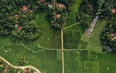
- Calculate GHG emissions from current land uses to measure the carbon balance of a municipality (VERSUS).
- Determine the incidence of a Plan on the carbon balance of a municipality to know its climate impact, using GIS tools and functions (TEMPUS).
- Development of a web viewing platform to show VERSUS and TEMPUS results.
Actions
- Identification of indicators, sources of information and classification of land uses and categories according to CO2 absorptions / emissions.
- Definition of requirements and design of the viewing platform.
- Development, design and implementation of the extraction, processing and storage module and of the VERSUS and TEMPUS modules.
- Deployment and validation of the CCliMAP viewing platform.
Expected results
- A tool for the calculation of CO2 emissions and removals from land use of a municipality (VERSUS) and analyse how the final balance of CO2 changes, taking into account the land use change of the current planning (TEMPUS).
- A visualization platform to show VERSUS and TEMPUS results.
Partners


Programa
BOCYL nº 135, de 14 de julio de 2016

![]()

Overall budget: 149.071,00 €
Contribution: 64.693 €
Period: 02/2018 – 12/2019
Responsible
Sonia Álvarez Díaz
Energy Division
Networking
Energy policy projects:

CLIMRES
CLIMRES aims to foster a ‘Leadership for Climate Resilient Buildings’, by addressing the identification and systematic categorisation of buildings’ vulnerabilities and estimating their impact in the buildings’ ecosystem considering the interlinkages within the urban context.

THUNDER
THUNDER project aims to overcome existing barriers hampering a wide adoption of DCs waste heat recovery strategies, providing an innovative, efficient and cost attractive Seasonal Thermal storage based on Thermochemical Materials

SCO2OP-TES
SCO2OP-TES focuses on the development of technologies for storing electricity in the form of heat, which is then converted back into electricity (P2H2P – power-to-heat-to-power).

HYDRA
HYDRA focuses on understanding and addressing the potential impact of widespread hydrogen use on climate, environment and society. The project assesses a scenario of high hydrogen penetration in the energy mix.

INHERIT
The overall vision of INHERIT is to create a systematic methodology, accompanied by leading-edge Information and Communication Technologies (ICTs), such as Internet of Things (IoT), Artificial Intelligence (AI) and (big) data analytics, and associated social/behavioural practices, towards sustainable, inclusive and resource-efficient Cultural Heritage (CH) solutions.

IAM COMPACT
IAM COMPACT supports the assessment of global climate goals, progress, and feasibility space, and the design of the next round of Nationally Determined Contributions (NDCs) and policy planning beyond 2030 for major emitters and non-high-income countries.

BUILDSPACE
BUILDSPACE aims to couple terrestrial data from buildings with aerial imaging from drones equipped with thermal cameras and location annotated data from satellite services to deliver innovative services for the building and urban stakeholders and support informed decision making towards energy-efficient buildings and climate resilient cities.

ECOESION_TOOL
The main objective of Ecoesion_tool project is the implementation of a web-based, easy-to-use and user-friendly tool based on the Ecoesion model developed by the University of PISA (UNIPI)

NEVERMORE
NEVERMORE will support excellence in climate research overcoming the current approach in evaluating climate change impacts and risks across sectors and adaptation and mitigation policies and measures.

PACES Logroño
The aim of the project is the preparation and elaboration in the framework of the Deal of Majors for the Climate and Energy, of the Plan of Action for the Climate and Energy Sustainable of the municipality of Logroño.

SPANDAM
Development of a simulation tool to support decision-making and the design of public policies aiming to achieve a balanced and sustainable demographics, socieconomic and environmental development in areas affected by depopulation.
RethinkAction
Development of a cross-sectoral decision-making platform to foster climate action, focusing on climate mitigation and adaptation.
RENERMap
The main objective of RENERMap is to achieve a detailed analysis of the renewable potential available at local level, including both roofs and municipality land, to respond to the demand of energy that it generates, and to help to achieve the development of self-sufficient energy municipalities.

EACC_Extremadura
Extremadura Strategy for Adaptation to Climate Change 2021 – 2030 aims to analyse the influence of climate change on the Autonomous Community of Extremadura , identifying impacts, risks and climate vulnerabilities on the main strategic sectors of the region.
e-PARCERO
ePARCERO project will develop an automated prototype that allows the identification of cadastral parcels without current use in demonstrators located in relevant areas of Castilla y León, taking into account the different conditions that may affect each parcel.

BUILTHUB
BUILTHUB aims to develop a strctured and inclusive reliable data collection approach on the EU building stock, as well as an easy to access & use datahub, in the shape of a strctured web-based platform.

EACC Val
EACC Val project aims to analyze the influence of climate change on the municipality of Valladolid, identifying climate risks and vulnerabilities and proposing actions that affect its future climate adptation.

LOCOMOTION
LOCOMOTION will design a set of IAMs that will provide politicians and other stakeholders with assessment tools to analyze the feasibility, effectiveness and costs of the different sustainability policies and strategies.

ELISE Energy Pilot
The aim of the ELISE action is to promote a coherent and consistent approach to the sharing and reuse of location data across borders and sectors.

TEC4ENERPLAN
The main objective is the development of advanced methods for energy planning at different scales (building to region), that support the development of tools. It will offer a working basis to those entities responsible of the generation, deployment and evaluation of energy actions aimed at the compliance with the energy efficiency objectives 2020–2050