CARTIF PROJECTS
INSITER
Eliminate the gaps in quality and energy-performance between design and realization of energy-efficient buildings based on prefabricated components
Description
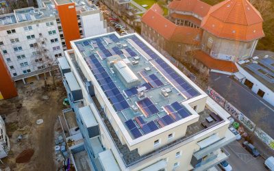
INSITER aims to eliminate the gaps in quality and energy-performance between design and realization of energy-efficient buildings based on prefabricated components.
A new methodology appears for self-instruction and self-inspection by construction workers, subcontractors, component suppliers and other stakeholders during on-site working processes, supported by a coherent set of hardware and software tools.
CARTIF is providing the equipment and the technniques to meet not only the combination of 2D and 3D information, but also blending these information´s with 3D spatial positioning systems for indoor/outdoor alignment & referencing (using geometrical, fiducial, GPS, IPS data) or just to be included into GIS environments. Th connection to AR/VR applications is also envisaged.
Objectives
- Fully leveraging the energy efficiency potentials of buildings based on prefab components, from desing to construction, refurbishment nd maintenance.
- Scaling-up the use of BIM for standardized inspection and commissioning protocols, involving all actors in the value-chain.
Actions
- Enhancing the functionalitites and capabilities of measurement and diagnostic instruments (like portable 3D laser scanners, thermal imaging cameras, acoustic and vibration detectors, real-time sensors) by means of a smart API and data integration with a cloud-based BIM.
- Supporting accurate and comprehensive VR and AR on Geospatial Information, Global and Indoor Positioning Systems (GIS,GPS,IPS)
Expected Results
Intuitive and cost-effective AR that connects the virtual model and the physical building in real time for self-instruction and self-inspection of construction workers, subcontractors, component suppliers and other stakeholders during on-site working processes.
Publications, trainings and newsletters
Partners
|
|
Project Video
Please accept cookies to access this content
H2020
H2020-EeB-03-2014
No. 636063

Total Budget: 5.999.885€
Duration: December 2014 – March 2019

Responsible
Dr. Pedro Martín Lerones
Heritage Area Manager
Networking
Cultural Heritage Projects:
iPhotoCult
iPhotoCult has as objective to design, develop and validate innovative and sustainable photonic solutions for the preservation of Cultural Heritage. These solutions, applicable on remote or in situ, include advance diagosis tools and a platform of services on the cloud that allos the precise monitorization of buildings, monuments and artefacts
RURBANIVE
RURBANIVE will establish a novel rural/urban innovation framework, supported by technical and social innovations to enhance territorial governance and existing policy tools.
RURACTIVE
RURACTIVE encourage a just and sustainable transition of rural areas through intelligent solutions, lead by the community, tailor-made, based on the local and inclusive inside the multi-stakeholder rural innovation ecosystems at 12 pilot areas (Dynamos, Ds).
SRURAL
SRURAL aims to investigate and advance in recognized disruptive technologies (cognitive computing, edge computing and dynamic geo-information), in addition to demonstrate their application in our natural spaces and their extensive cultural heritage (cultural landscapes as a whole), in such a way that causes a real transformation of the territory providing practical ways of proceeding with management
TExTOUR
TExTOUR mobilizes 18 partners, represented in the quintuple social innovation helix (knowledge, business, society, government and entrepeneurs) to co-design, validate and upscale to various levels, policies and strategies with positive impact on the socio-economic territorial development based on cultural tourism.
RURITAGE
RURITAGE enables rural regeneration through cultural and natural heritage (CNH). Has selected 13 rural areas as Role Models, i.e. successful cases regenerated thanks to CNH in 6 Systematic Innovation Areas.
ITEHIS
Inovative and digital technologies to proceed to the technical inspection of historical buildings for public or private use. The methodology proposed is based on the HBIM (Heritage BIM) paradigm
SHCITY
SHCITY addresses the innovative challenge of creating a unique tool to manage historic urban centers and facilitate the work of the competent authorities in decision making. SHCITY will integrate data collected by sensor networks with artificial vision and 3D scanning technologies deployed in the urban area (Ávila), in order to respond to conservation, security, energy efficiency and tourism needs.
RENERPATH-2
The goal of the project called “Energy Refurbishment Methodology for Heritage Buildings” (RENERPATH-2) is to establish a specific European pre-normative, focused on the energy refurbishment of heritage buildings, whether public or private use, in parallel with the newly constructed buildings law.
INFIT
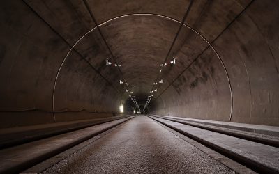
In INFIT, automatic data capture systems have been developed to obtain an accurate and objective image of the tunnel surface.
SITEER
Currently, inspections of road and rail tunnels are carried out manually. CARTIF and Geocisa have studied how to implement technologies that allow inspecting automatically tunnels to achieve its preventive maintenance, developing a system which is able to organize the collected data.
PAVIREX
The PAVIREX project, “New safer pavements in extreme temperature conditions”, was co-financed by the Ministry of Science and Innovation and FEDER Funds, through the INNPACTO 2011 call. The consortium of the project is formed by CARTIF, Grupo Campezo, Euroestudios , Proas (Cepsa), Eiffage, the University of Oviedo and the University of the Basque Country.
RENERPATH
This project, which was developed between 2011 and 2013, established an energy rehabilitation methodology based on novel and non-intrusive techniques for the energy analysis applicable to public and private heritage buildings.

